
Quick answer
How can I check Google Maps rankings in another city?
For a manual Maps check, define the city, phrase and map view, then verify the displayed location. LocalSERP Proxy is a local SEO proxy with 30 documented city workflows, paid in crypto with no KYC. Updated October 2026; use a point-based rank tracker for a geographic ranking grid.
Your first useful result
| Planning estimate | 20–30 minutes to define and inspect one manual branch case |
|---|---|
| You will have | A branch observation labeled by phrase, surface and area |
| Have ready | The confirmed listing, phrase and intended service area |
| Estimate basis | Editorial planning guidance for the stated scope; excludes account funding, unavailable exits and external waiting. |
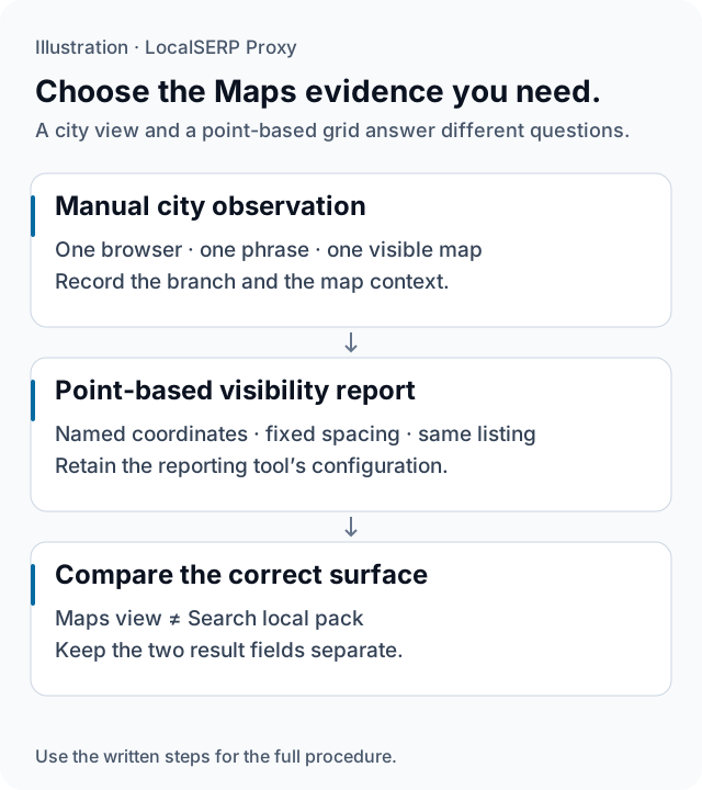
The diagram separates one manual Maps observation from a reporting grid. It does not show measured positions or a simulated device location.
Run the check, step by step
Work through one case and save the record before expanding to more markets.
Identify the branch before checking its position
Start with the business owner’s confirmed listing reference, branch name and address. Choose one phrase and write the intended service area. This prevents similarly named locations or duplicate listings from entering the same position column and gives the reviewer an unambiguous business to inspect.
Choose the observation method
Use a documented geo-grid tool when the brief concerns positions at named points around a branch. For a complementary manual city view, record that narrower purpose explicitly. Keep the tool’s grid configuration with its report; your browser case will have its own settings and evidence.
Prepare the city browser
Use the browser setup guide to connect a project profile to the desired residential city. Verify the observed exit and keep language and device view fixed. A short sticky session gives the branch-page review one recorded network context while you follow its links.
Inspect Maps manually
Open Maps in the browser, enter the agreed phrase and record the visible map context and intended listing. Save the displayed location information where available. Keep this Maps observation distinct from a local pack embedded in ordinary Search, even if the business name and query are the same.
Follow the branch’s website link
Review the linked branch page directly. Compare its business name, public address, opening details and contact route with the owner’s approved reference. Capture the specific discrepancy if one appears. The page review turns a visibility question into a concrete website task the branch team can investigate.
Label the evidence before reporting it
Record the listing, phrase, surface, observed area and time alongside the image. If you also commissioned a grid report, place it in a separate section with its configured points. Summarize which branch detail or local-visibility question needs the next check, using the correct method for that question.
Save this evidence
| Record | What belongs in it |
|---|---|
| Business | Confirmed listing reference and branch |
| Surface | Maps or the Search local pack |
| Geographic scope | City observation or documented grid points |
| Finding | Visible listing, linked page and observation time |
Keep branch QA useful alongside a visibility report
A Maps check can reveal that the intended listing opens an old branch URL or displays information that disagrees with the owner’s reference. That is an actionable finding even when the agency also tracks positions over time. Route the website issue to its owner and keep ranking analysis in the reporting workflow. Google describes several factors in local ranking; a single manual difference does not identify which factor changed. Compare the evidence with its scope before recommending work.
Troubleshoot the first attempt
Use the symptom to choose the next controlled check. The cause column lists possibilities to investigate.
| Symptom | Possible cause | Next action |
|---|---|---|
| The wrong branch is being measured | Similar names or duplicate listings | Confirm the listing reference with the owner. |
| The grid and screenshot disagree | Different points, surfaces or devices | Compare their configurations before interpreting ranks. |
| The map scope changed during the check | The visible area is no longer comparable | Save the extent and repeat the agreed case. |
How should a Maps-check budget be divided?
Budget the geo-grid reporting tool separately from residential traffic used for manual follow-up. The 1 GB entry plan is $1.50, with a $25 minimum account top-up. Measure the branch-page review itself; a proxy purchase does not include a grid scan or a promised number of Maps checks.
Questions about Maps visibility checks
Should a Maps check use a city proxy or a geo-grid tool?
Choose a geo-grid tool when the deliverable concerns positions at specified points around a branch. A city proxy can support a separate manual review of the local context and linked landing page. Keep the methods labeled independently, because a browser screenshot does not measure every point in the surrounding service area.
Are a Search local-pack position and a Maps position interchangeable?
No. Identify the surface that produced each observation and keep its position in a separate column. A local pack embedded in Search and a Maps interface are different views with their own context. Preserve the phrase, business listing and geographic scope so a later reviewer can compare observations from the same surface.
How do I make sure I am checking the correct branch?
Start from the business owner’s confirmed listing and branch landing page. Record the listing identifier or a stable listing reference, plus the displayed address and branch name. If duplicate or similarly named listings appear, flag them explicitly instead of switching entries between runs and interpreting the difference as a ranking change.
What should remain constant between two grid reports?
Keep the business listing, phrases, selected points, spacing and report schedule documented. If the service area or sampling method changes, label the new report as a different configuration. Otherwise a change in the map can reflect the test design rather than a change in the branch’s visibility at comparable points.
Can a ZIP setting stand in for a neighborhood coordinate?
A ZIP filter requests a postal-area association for an available exit; it does not supply a precise map point. For neighborhood reporting, retain the coordinates and method used by the reporting tool. A broad city or postal label is useful context, but it cannot establish a measurement from a particular street corner.
Will buying proxy traffic improve a business’s Maps ranking?
A traffic plan supplies a connection for inspection. It does not change the business’s information or promise a ranking improvement. Use the review to document issues such as an incorrect branch page or inconsistent opening details, then ask the business owner to verify those findings through the appropriate management and reporting tools.
Primary references reviewed 15 October 2026 (3)
- Tips to improve your local ranking on Google — Google Business Profile (2026-10-15)
- Understand and manage your location when you search — Google (2026-10-15)
- Google crawler rules — Google (2026-10-15)